
Bridge Surveys
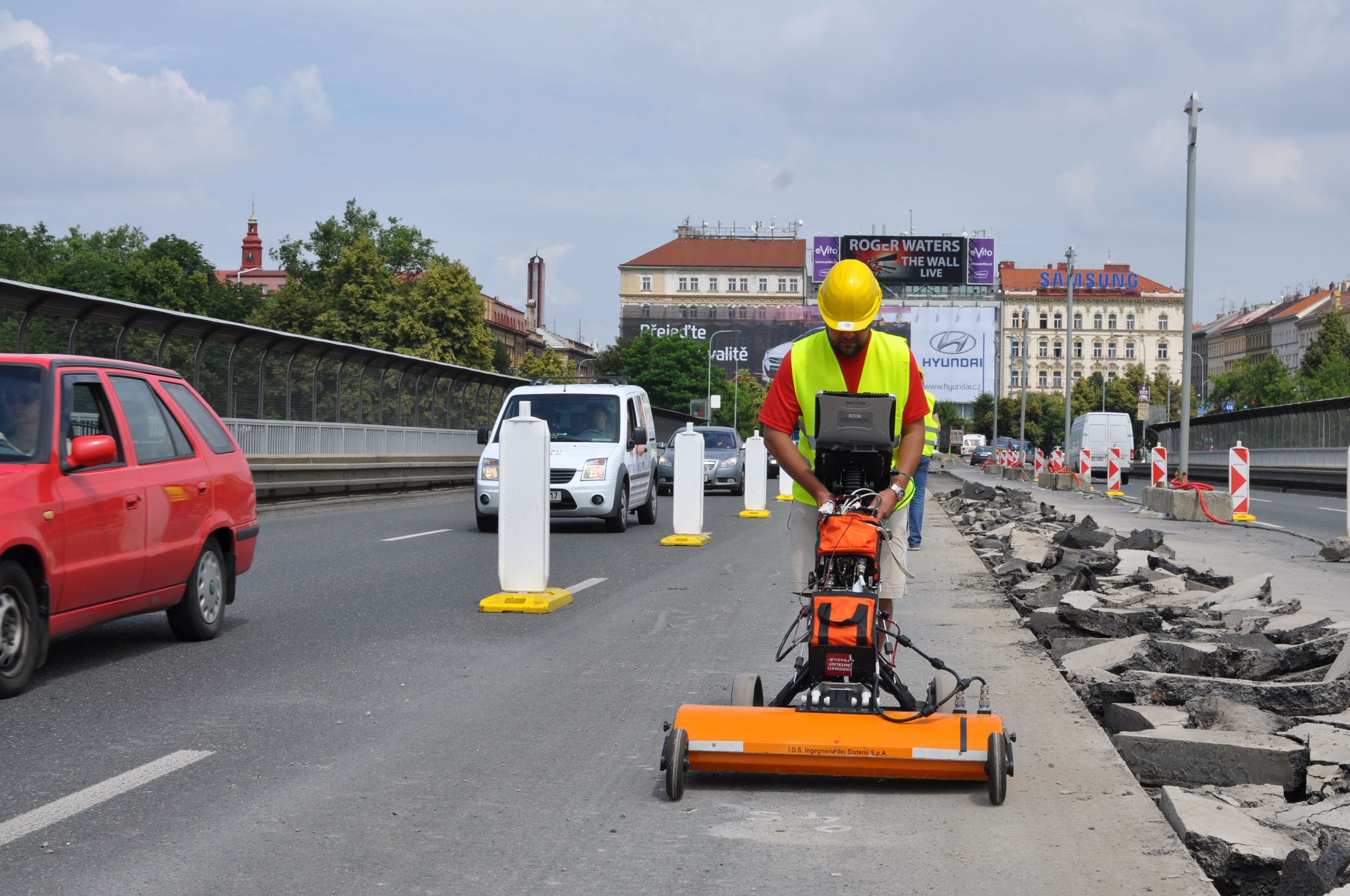
Bridge deck condition mapping using NDT techniques
Roadscanners has performed extensive research and development work in order to develop further NDT techniques and their data analysis with the aim to better map the condition of bridge decks. These techniques are used both for network level bridge asset management and for project level in detailed bridge diagnostics. NDT techniques that are mainly used in these diagnostics are GPR data analysis, thermal camera surveys and laser scanning.
Increasing the lifetime of bridge deck
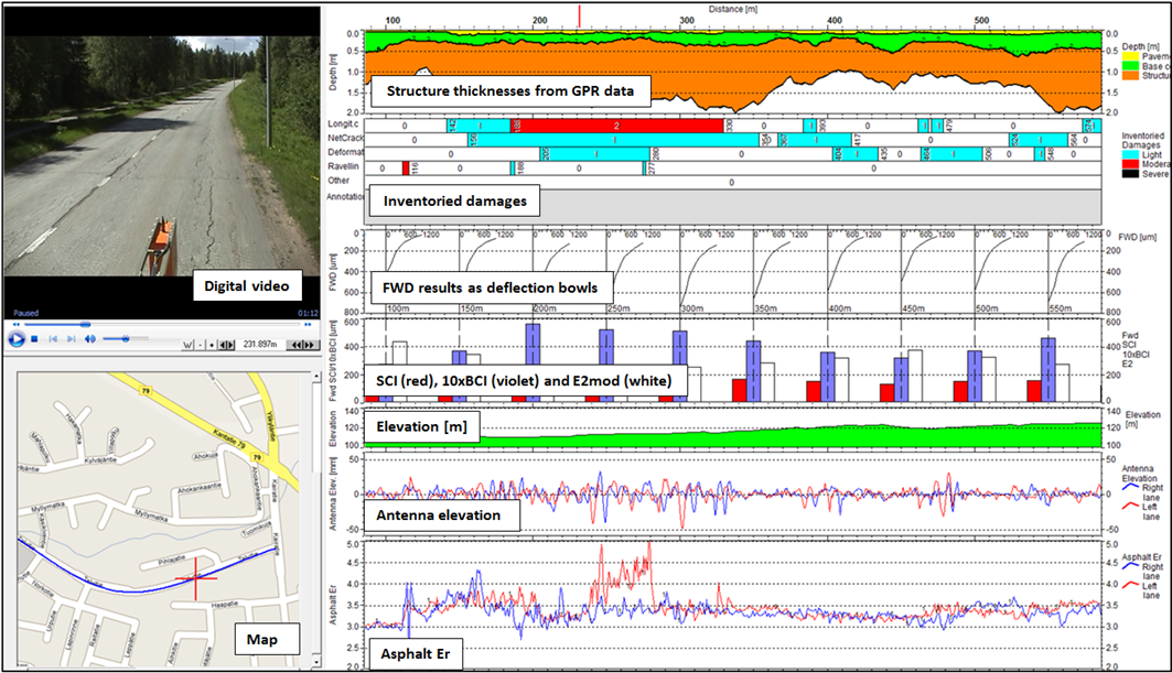
The main tool in bridge surveys has been Ground Penetrating Radar and roadscanners has been using several 2d or 3D GPR systems in these surveys. The focus in network level bridge surveys is to collect, analyse and report early phase deterioration indicators for the whole bridge deck. Based on the survey results a proactive maintenance plan can be created which will considerably increase the life time of bridge decks and result in major savings regarding bridge deck rehabilitations. In project level surveys the focus is mainly to map deteriorated areas and their depth on the bridge deck to provide information for repair design.
Quick and cost effective way
GPR bridge deck survey is a quick and cost effective way to provide combined analysis results concerning:
- Internal structure exploration through 2D and 3D underground maps
- Bridge problem diagnostics
- Layer thicknesses determination
- Voids and delamination detection and location
- Water infiltration and chloride contamination location in concrete
- Subsurface utilities detection and location
Thermal and laser scanner remission maps are indicating anomalies on the bridge deck that enable better localizing the damaged areas to be repaired.
Airport Surveys
Runway and taxiway structural condition evaluation and monitoring

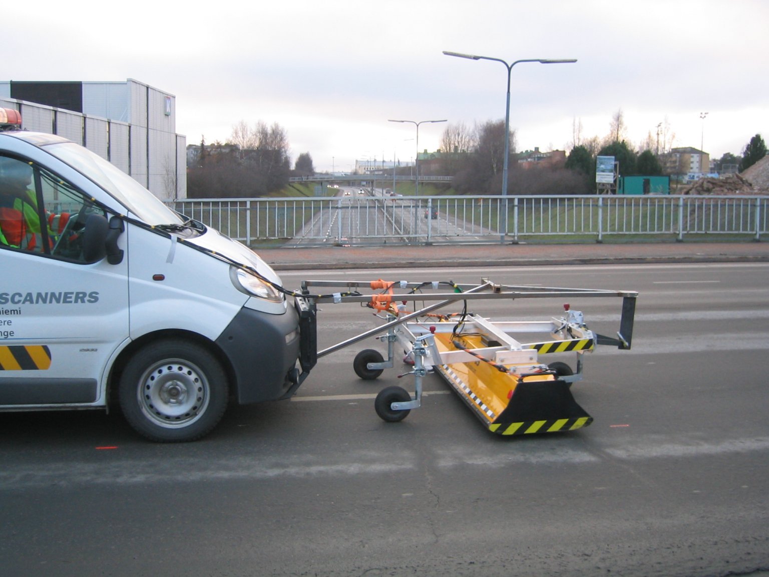
GPR Applications on Airports
Runway and taxiway structural condition evaluation, forensic and environmental surveys (night survey achieved at a speed of 60 to 70 km/h without any impact on either safety or flight traffic).
- Asphalt and pavement structure, thickness and material type
- Pavement distress diagnosis
- Moisture surveys and monitoring
- Detecting cavities and washouts under runway and taxiway
- Detecting cables and pipelines under the runway and taxiway
- Environmental surveys
RDLS GRID Powerline Surveys
Economical way to locate places along powerlines where tree removal is needed
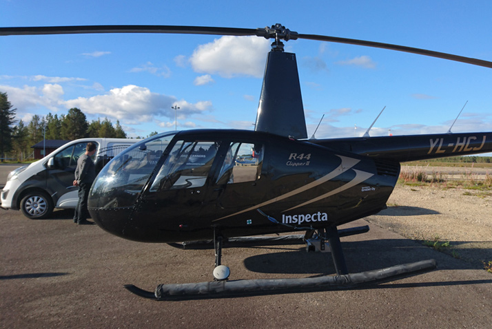
Helicopter based LIDAR Powerline Surveys
RDLS Grid technique enables quick and affordable way to locate places where falling trees or branches bent by snowload may cause damage to powerlines. The service provides detailed information on where trees need to be removed. By removing trees, the potential damages caused by storms and falling trees can be prevented.
WATCH THE VIDEO
Turnkey Solution
- Laser Scanning (LIDAR) from Helicopter
- Data processing and analysis
- Results presented on GIS maps
- Images with different cameras
- Visual damage inventory
Mapservice on Browser
- Easy-to-use also on mobile devices
- Action plans
- GPS tracking
- Pictures and notes can be added
- Open map interface and general GPS format
support
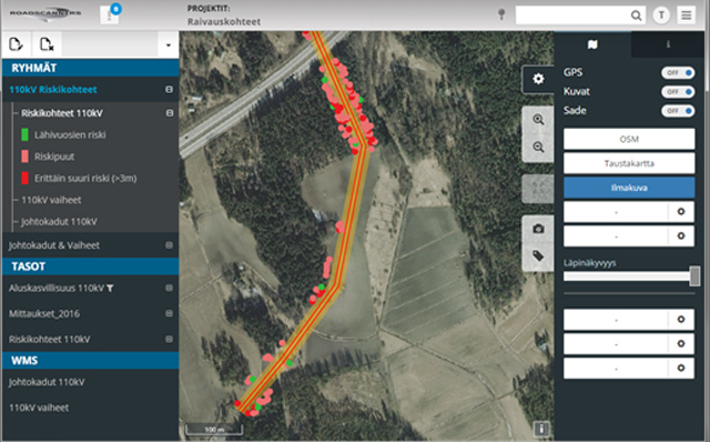
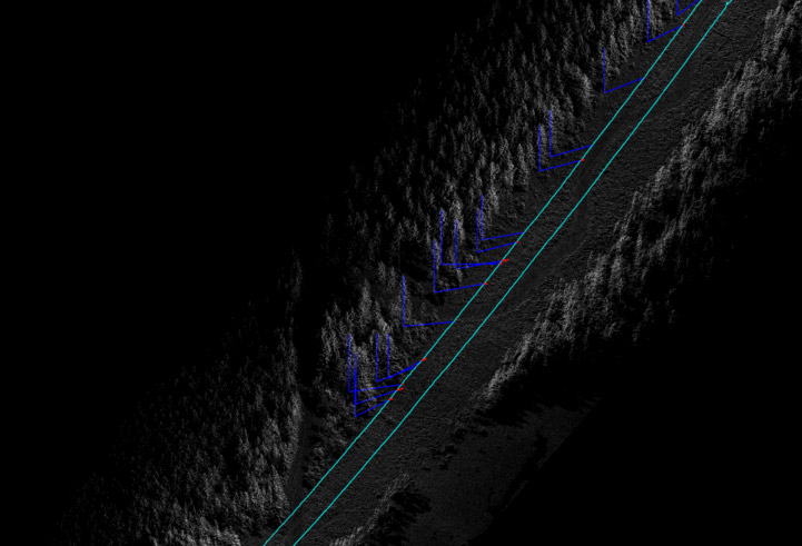
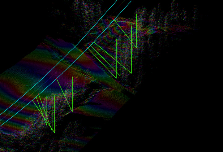
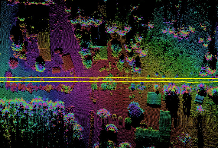
Following are few examples of results showing powerlines and the trees that might hit the line.
IN CO-OPERATION WITH
Enabling the benefits of new technologies
- Detect the root causes of damages and road problems
- Determine the exact location and dimensions of the problem areas
- Adapt new design practices to solve the problem
- Learn to move towards proactive pavement maintenance policies
- Get longer pavement life times and better roads
- Gain savings with asset management costs
Roadscanners’ surveys and analysis uses the latest technologies: GPR, laser scanners, thermal cameras and accelerometers, as well as deflection surveys.
Click the picture to see it larger.
Contact us
Roadscanners locations
Roadscanners’ main office is located in Rovaniemi, Finland. The company also has consulting offices in Tampere and Helsinki Finland. Currently, the group also has four subsidiaries, Roadscanners Sweden AB, located in Falun, Sweden, Roadscanners Central Europe s.r.o, located in Prague, Czech Republic, Roadscanners Norway AS in Narvik, Norway and Roadscanners USA Inc., Delaware, USA.
Main office Location
55-59 Adelaide St, Belfast BT2 8FE, United Kingdom
Alphadevelopmentseu@gmail.com
Folow us